I'd heard about this road to Jomsom, and that it was quite a challenge. I'd seen a blog that showed photos of sections and it didn't look too bad, so I thought I'd give it a go. It means I could beat my altitude record of 2600m in Thailand, and possibly get to 3800m at Muktinath on this road...
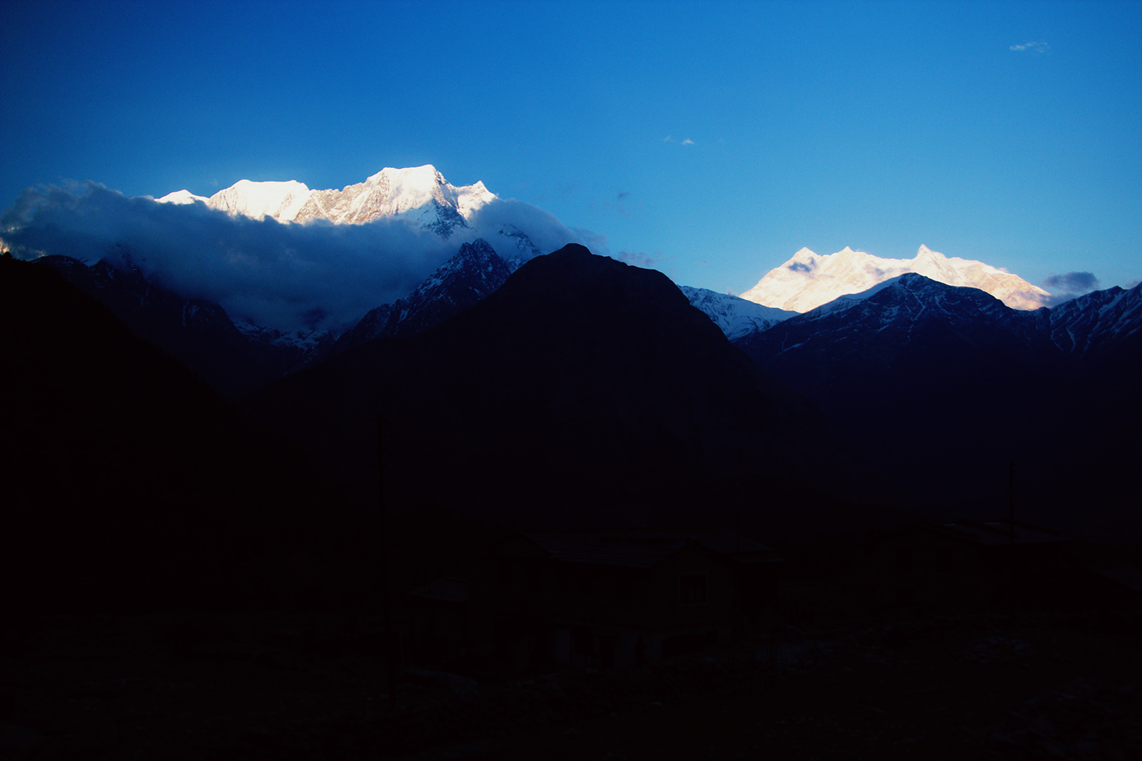
The mountains from Pokhara
Attempt 1!
I'd met this guy via the Horizons Unlimited forums in Pokhara. He's travelling from Adelaide to London on a Vespa... Which is crazy! On the morning I was going to head up to Jomsom we met up for breakfast to copy movies/tv shows. Unfortunately the copy went on for a bit too long and ended up going past lunch time (I was in no rush to move anyway). I left about 1:30pm and changed hoped to make Tatopani by 6pm instead of Jomsom. I now know that would have been impossible too.
I headed out of Pokhara and followed the road north through the valley. Once it started to climb up the hills on one side I felt a few raindrops and saw some dark grey clouds in the north. I thought that would have been ok, there's a large loop in a south westerly direction before it heads north again, it looks like the rain should have passed that area.
However... Once I got to the top of the hills the wind really picked up. I was in a small village at the top when I noticed ahead of me there was a lot of wind and dust and leaves being blown across the road between a small gap in the hill. I looked up to one of the buildings and noticed a bit of roof leaving its house. I found shelter and waited the wind, then the hail, and rain out. That took about an hour, and since I was so close to Pokhara, and a distance away from Tatopani along unknown roads I decided to head back down to Pokhara and attempt again the next morning.
Storm cleared slightly so I could get my bike in the way of a photo.
Attempt 2!
I got away at 8am this morning, but I struggled to finish my breakfast, possibly getting sick again... I pushed on through the valleys towards Beni.
The road was fine today, weather was great (as it is every morning here). There's the one climb over the mountains at the end of the valley to 2000m, and then it drops back down to 800m again like in Pokhara. It stays much the same until you get to Beni.
The road from Pokhara is not bad. A couple of spots where you could get caught out if going too quick. And as always buses everywhere.
Views along the way to Beni
More views.
About 20km out of Beni I stopped to get fuel and there was a scottish guy called Ash. He had hired a scooter for 400r a day and was attempting to get to Jomsom. I told him from what I heard it was actually quite rocky and in bad condition, but he was going to give it a go. He said he'd already been up to Beni on the scooter, but they didn't have fuel so he had to come back out. Lucky I stopped here.
I set off and hit the horrible gravel roadwork section on the way to Beni which is just after a bridge over the river. Now on the maps there seems to be a road on the other side of the river, but I decided to trust the GPS advice and stay on this side (which is where other maps said to go). But I wasn't actually sure if this was the road to Beni or if I'd be getting to the end of the road to find beni on the other side of the river and no bridge. I persisted, I only had about 10km to cover before I had to back track (if needed). I went through some mud, some rocky sections, a lot of gravley dusty road, all the time wondering if this was infact the correct way to go. Got to a very muddy section, It looked very slippery but actually wasn't, but then I wondered about Ash on his scooter, how did he make it through? Eventually I caught up with him and passed, so now I was releaved that I was on the right path.
At Beni I stopped for a drink. I saw Ash ride passed still persisting on the rented scooter.
After Beni the road gets worse, lots of sandy dusty crap covering the road. The front on my bike would slip a bit, but it seems if I keep the power up it's ok. But you can't use too much power because you don't want the rear to slip out (had that happen before...).
I caught up to Ash again he made it quite a way on his scooter! I stopped and remarked at how bad the road was to here, I told him if he can handle that he can get to Jomsom no worries! But I was wrong.
At Tatopani it starts to get muddy, rocky, and a lot tougher. It's very slow going. And then once you get to Ghasa it starts to get steeper and rockier and even harder...
Views north of Tatopani (closer to Ghasa I think)
Looking up the valley.
I was getting quite tired after I did the last little climb up to Lete, and by the time I arrived I noticed some drops of rain. Then the very cold winds came in. It had taken 6 hours to get to this point, and 5 hours of that was covering the 50km from where the road starts to get bad. I decided to stop there for the night rather than push on to Jomsom because the rocks became very slippery with the few drops of rain that hit them.
I found a guest house and unpacked all my gear. Once I got inside I started to get a really bad headache. Later in the afternoon the headache got a lot worse. I checked my blood pressure a few times and it was WAY up. between 140/90 and 160/110 each time I tested, heart rate seemed to stay above 100. So just lying down was exhausting...
This was nearby...
Behind the guesthouse.
The road up to Kalopani and Jomsom.
More Mountains.
My room was in the top left. I felt very cold at night, mostly from being sick.
Closeup of that shiny section.
Sunset happening outside this valley.
Getting redder...
Almost gone...
Post sunset Lete.
The night was horrible, lots of waking up. I checked my blood pressure a few times and it was still up, still had a bad headache and intestines still hurt a bit.
The next morning I felt better, blood pressure was down to 130/80, heart rate had finally dipped below 100. I ate breakfast of toast and jam, and boiled eggs. Little did I know that the Jam had far more fructose in it than I thought. Jam is supposed to be realativly safe for fructose intollerant people, but this one listed pectin as an ingredient. Sugar was still first however so I thought it would be ok. But it was not. About lunch time the intestine pain got much much worse and it felt like my intestines wanted to rip out of my body briefly. And the headaches got worse. I could hardly move.
Morning time in Lete.
North along the road. I think this one is 8000m. The bottom of the photo would be around 3000m
Wider view looking north.
Some of them UFO clouds above the tallest mountain.
Some light cloud rolling over the top of this one.
I spent the afternoon in pain and watching movies (air america) but my combined diseases did manage to ease up a bit. That is until the evening and then the altitude sickness got much worse.
That night I attempted to eat something, but could only eat half a plate of chowmein. I went back to my room and pre-packed everything ready to go tomorrow. In the morning I got up and still felt horrible, blood pressure and heart rate still in the region of someone who should be running and not lying down I figured it was best to get out of here.
Here's a bit of video of riding down the rocky road out of Lete. This was one of the harder sections, it was made even worse because I wasn't feeling so well and couldn't concentrate properly.
Once I got to Ghasa I started to feel a lot better, it was only 400m down, but that helped a lot. The village of ghasa has a path through it which runs parallel to the road. However on the road was an overturned bus. Everyone started waving at me so I turned around and then went down the path through the village. My bike handles steps well! I have the video from riding through it but I'm having trouble uploading things.
South of Ghasa there's a broken bridge with a deeper water crossing next to it.
The waterfall, bridge, and goats.
Goats!
Stay away from my bike goats!
This is the old broken bridge with some rocks stacked at one end, and the deep water crossing.
Being awesome, I decided to take the bridge back across instead of the water. My left pelican case still has a broken hinge so it's waterproofiness is unknown, and I wasn't sure of the depth of the water. Here's how I went across:
The mud had mostly dried up from two days ago. Still some slippery sections though. I've got more video of it to upload. I stopped near Tatopani to get a drink.
The river heading down the valley.
Napping Nepali Guy.
I saw motorbikes take this across the valley.
Closer towards Beni.
But this is a tough road. Now I know what it's like it would probably be best to take it was a week long trip. 4 days up to Jomsom, a day at Muktinath, and 2 days down. I failed at beating my altitude record, looks like I'll have to do that elsewhere.
Todays trip is to Tansen or Lumbini. I'm packed and I just have to put everything on the bike and go. But I've been near Pokhara for so long now. I'm not sure how possible it is to leave!
I left Mae Hong Son and headed towards Mae Chaem which is a small town near the base of Doi Inthanon. I spent most of the day riding through roads like this:
On the right is Doi Inthanon, I think. I looks like that anyway.
Some cows at the top of this pass (about 1300m)
Wait... What country is this? Also, the sky was particularly clear and blue so the polariser almost removed it.
I got to Mae Chaem and had a quick look around and checked in to the Mae Chaem Resort (400b/night for a bungalow). There's not a lot in this town but there are some backpackers and other tourists about, but not a huge amount of choice in places to stay. There are 4 other motorbikes here tonight too.
Doi Inthanon from the back of Mae Chaem Resort. It's 2565m tall and this photo was taken at 640m. It really doesn't look that impressive from here.
The field behind my little bungalow.
My bungalow!
Doi Inthanon from a bit closer, at about 1200m here.
So I had a whole day to go and explore the mountain and some of the waterfalls. It was cold in Mae Chaem so I put on all my warm gear because I thought it would only get colder at the top. Which it did, at about 2200m, and I know my bike isn't jetted quite right but it only lost a little bit of power towards 2400m. And then I made it to the top!
The view from the carpark. This is about the only place you can see off the mountain from the top, there are trees surrounding it everywhere else. There's a military weather radar at the carpark too which has a big sign saying "Photography is Forbidden".
Stairs leading up to the actual top, guarded by stone elephants.
The elephants accept donations.
The highest point I've been on land! A new personal record for me and my bike! The previous record was 2032m in Malaysia.
And the actual highest point is just behind the sign at the memorial for King Inthawichayanon, who was the last king of Chiang Mai. His ashes were spread here.
The memorial. People would buy flowers further down the mountain and then leave them here.
A little elephant, guarding his ashes.
More of the memorial.
They had a cafe near the top too so I wandered down and got some really high coffee.
Stairs to the cafe.
The temperature.
11 degrees... It felt much warmer than that. In the sun it was a lot hotter and I think it warmed up quickly. I had to remove a couple of layers from my jacket.
Ha! Beat that, bikes that have not been here!
Looking over the edge...
I headed down to the next big stop with a better view off the mountian. There are two Chedis on the top of the mountain (which you can see from Mae Chaem) for the King and Queen.
This is the Chedi for the King.
I went to visit both of them which is rather easy because this is how you get up there:
Yup. Escalators.
There are signs up warning not to do anything to stressful because of the altitude but this was only at 2200m. I felt fine but I still took the escalator!
Panorama time! Sky darkened by the polariser. On the left it was whiter cloud/smog/mist and the right had more smoke.
Really dark sky, thanks to polariser. The sky was actually very bright and almost hurt to look at.
That's Mae Chaem down in there.
Looking across to the chedi for the Queen.
The garden at the top.
Odd little face smashed in thing...
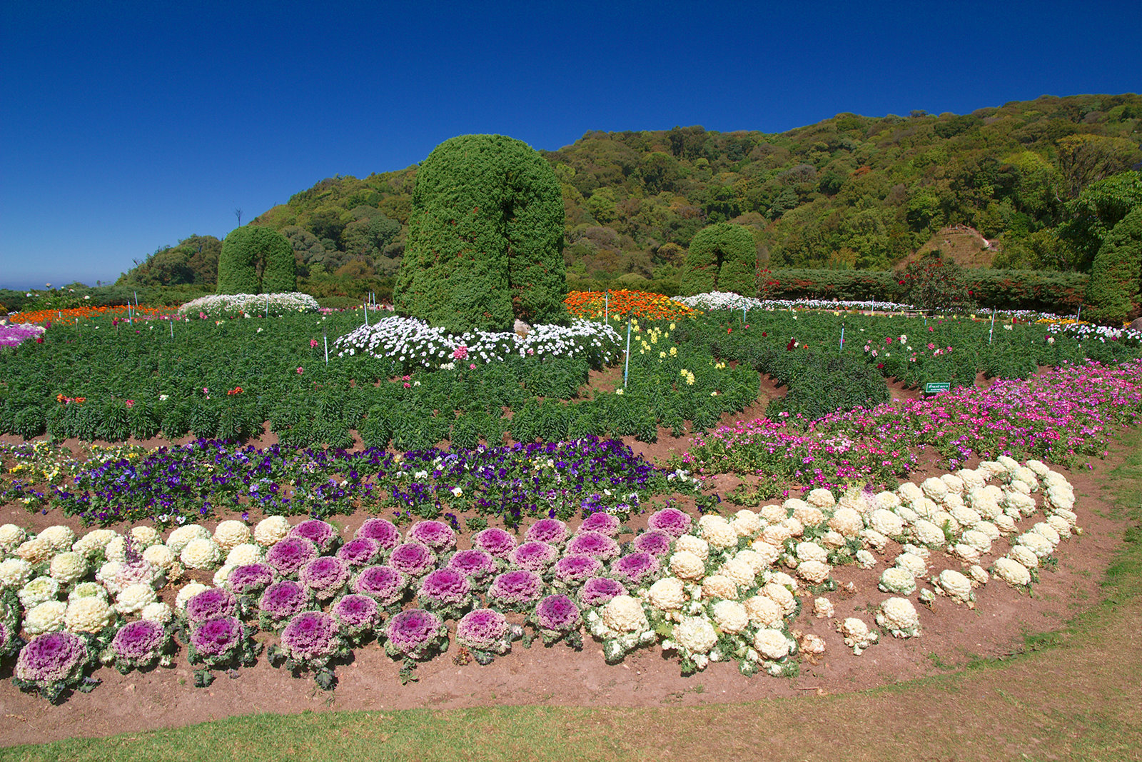
Ornamental cabbages! Ha! I know what they are! Actually I'm not sure, there was a sign, but not sure if it was referring to these.
The road down.
More of the road...
Then I went off to find some waterfalls!
First off was Siriphum Falls.
This was in the park below the falls.
More park.
The actual falls... No idea how I get closer to there.
Next was Hui Sae Lueang Waterfall.
Now, right in the middle of this photo is a very rare bird apparently. A white crested something or another that migrates from Nepal. There was a group of birders there and one was very happy to see this and pointed it out to me.
The actual falls.
Next was just a short ride, and a lonnnnggg 500meter very hot trek to Mae Pan Falls. There was a fork in one part of the trail so I took the way that looked correct. This path ended up on the rocks, so I climbed over the rocks to try get a better view of the main falls. Then I could see a sign up a little higher, so after a short climb I ended up back on the path I should have taken...
Water!
Base of the falls with a little rainbow action.
The full falls!
This was the path I should have taken...
And then that was all my fun for the day...
Today I'll head back to Chiang Mai via some more waterfalls (and maybe the summit of Doi Inthanon again).